Source: BRIMAS
Sarawak Government plans to build more hydro-electric dams to meet the state’s future industrialisation needs. In addition to the Bakun dam project, the Sarawak Government are planning to build another 12 hydro-electric dams at Ulu Air, Metjawah, Belaga, Baleh, Belepeh, Lawas, Tutoh, Limbang, Baram, Murum and Linau rivers including an extension to the Batang Ai Dam.
Sarawak Energy Berhad (SEB), 65 percent owned by the Sarawak is spearheading these dam projects.
The projectThe Batang Baram is the second longest river in Sarawak. The river drains much of the Sarawak northern region as it originates in the central Iran Mountains at the Sarawak/Malaysia-Kalimantan/Indonesia border. It flows westwards through tropical rainforest in the Baram District to the South China Sea. The Miri Resort City is located at Baram delta.
The Baram Hydroelectric dam site is located along Baram River at about 306 Km from the river mouth. The location of the dam across the Baram River will be between the inflows of the Sungai Patah and Sungai Kahah from the left and Sungai Hit from the right, as going upstream.
The height of the main Baram dam would be 162 m above foundation level. The dam structure across the Baram River has a crest length of 685 m and the crest level is 180 m above sea level. The construction would be designed as a roller-compacted concrete (RCC) gravity dam. Due to the topographical conditions in the project area, a 70m high Saddle dam will be constructed approximately 5 Km south-west of the project site.
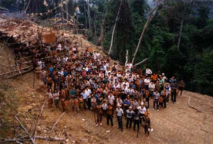
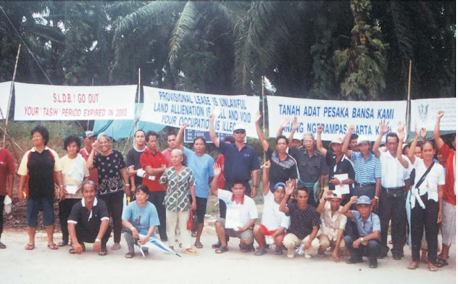
Who are affected by Baram dam?If the project goes ahead, an anticipated of at least 20,000 indigenous peoples will be affected and displaced by the dam. These peoples are the Kayans, Kenyahs and Penans whose longhouses and villages are situated along the course of Baram River valley, locally known as Telang Usan. Their settlements are well located on below, above and around of the project site.
The downstream longhouses/villages are Long Laput, Sungai Dua, Sri Kenawan, Uma Bawang, Long Miri (Daleh Pelutan), Long Pilah and Long Kesseh. In the upstream and within the dam reservoir area are Long Na’ah, Long Liam, Long San, Long Selatong (Kiri & Kanan), Long Apu, Long Julan Asal, Long Julan Pelutan, Long Anap, Long Palai, Long Je’eh, Long Moh, Long Sela’an and Long Semiyang as well as some villages in Akah River that are Long Beku, Ba Abang, Long Tap and Long Tebangan.
The Baram dam would submerge an area of 38,900 hectares (389 sq km) of land and forest. The area is mostly native customary land, and consists of temuda, cultivated lands, gardens, villages, churches, graveyards, community forests and sites of historical significant. The people are going to lose their longhouses, villages, properties, lands and forests as a result of submergence and displacement by the Baram dam.
The construction of Baram dam will create a catchment area of 896,600 hectares (8,966 sq.km). Within the catchment area are some major settlements of indigenous communities: the Kenyahs, Kelabits, Sabens and Penans.
The dam will submerge the existing government schools, Medical clinics, airstrip and other building facilities. There are also logging companies actively operating in the area.
Baram Dam Project Features:Main dam
Type RCC
Crest of dam 180 m a.s.1.
Height of dam 162 m
Length of dam 685 m
Saddle dam
Type Rockfill
Crest of dam 180 m a.s.l.
Height of dam 70 m
Length of dam 1,290 m
Reservoir
Normal water level 178 m a.s.1.
Minimum water level 177 m a.s.1.
Total storage volume 13,2 x 10⁹ rn3
Reservoir area 389 sq km
Power plant
Installed capacity 830 MW
Design discharge 684 m3/s
Design head 138 m
Average energy generation 5,848 GWh/a
Turbine type Francis –vertical axis
Number of units 4
Catchment Areas 8,966 sq km